Manish Tewari | Equal Earth, Unequal Lines: UN Remapped Sovereignty

Yaryna Ferencevych, the US deputy representative to the UN Economic and Social Council, labelled the initiative as part of a broader “radical ideological project” being pursued by the United Nations when it should be focused on “genuine problems of international peace, prosperity, or good relations”
In India, where a boundary drawn out of line can carry a prison sentence, cartography has never been about neutral geography, it is an uncompromising assertion of national sovereignty written in solid ink.
On September 4, 2026, the United Nations General Assembly voted 164 to 1, with six abstentions, to accept something cartographers have known for two centuries and everyone else preferred not to notice, that the standard world map is economical with the truth about Africa’s size.
The lone vote against came from Washington DC, which dismissed the whole exercise as rather unnecessary. Yaryna Ferencevych, the US deputy representative to the UN Economic and Social Council, labelled the initiative as part of a broader “radical ideological project” being pursued by the United Nations when it should be focused on “genuine problems of international peace, prosperity, or good relations”. “Resolutions like this and the ideological agenda they promote are barnacles on our work here and the reason this institution is losing its credibility,” she articulated vehemently.
Nobody in the hall that Friday seemed especially worried about India, Japan or Ukraine.
They should have looked carefully two months ago.
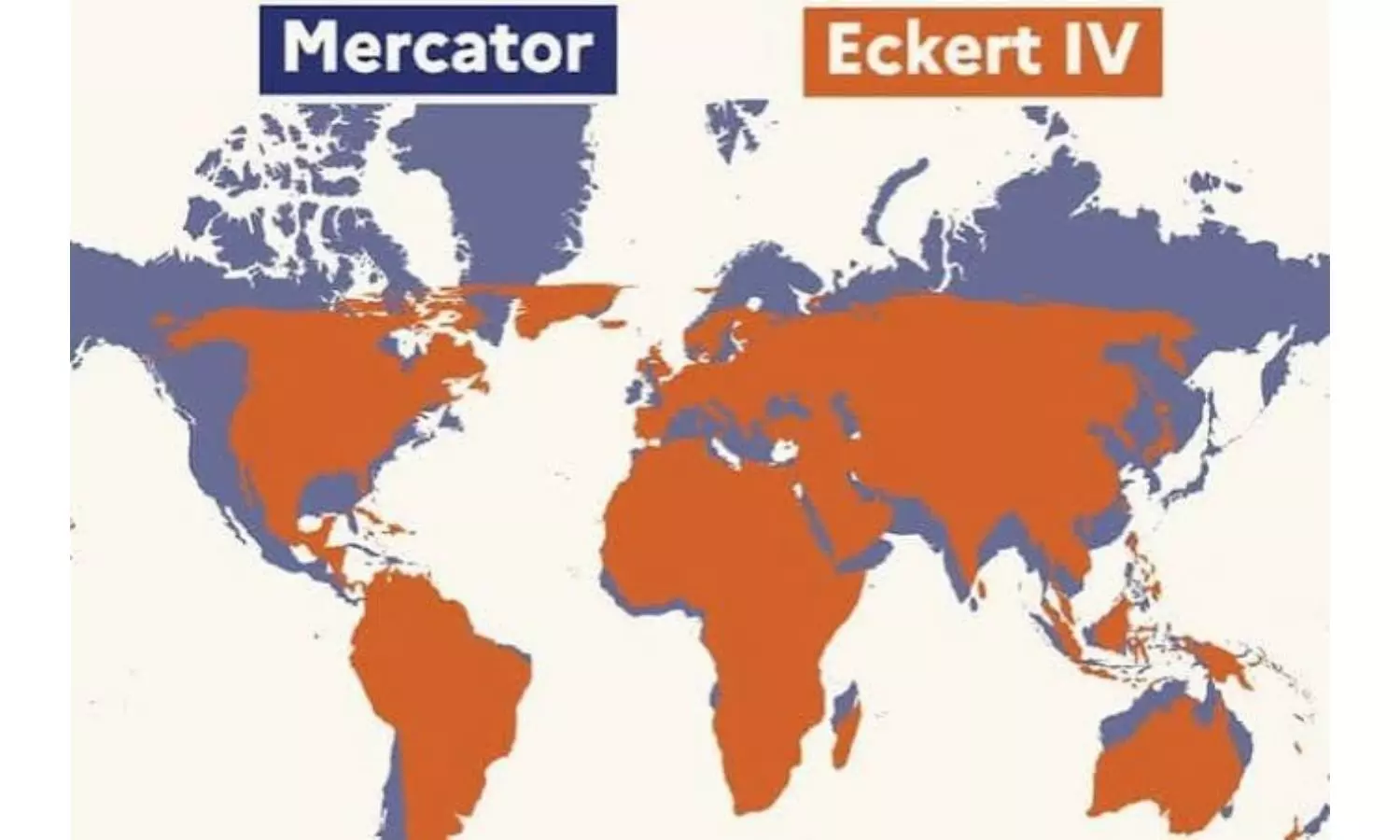
The resolution, titled “Correct the Map,” was moved by Togo on behalf of the African Union, and catechises governments, schools and technology firms to retire the 1569 Mercator projection, which inflates everything far from the equator until Greenland looks the size of a continent it could fit inside 14 times over.
In its place it recommends Equal Earth, a projection three cartographers built in 2018 specifically to preserve true relative area of the respective continents. This is a genuine fix. What actually upset India, Japan and Ukraine two months later was a different, quieter document.
That document is the UN’s own “Map of the World,” a reference sheet that UN agencies and much of the multilateral system treat as gospel. Its Geospatial Information Section quietly issued a new edition on July 1, 2026, two months before the vote. The secretariat’s own cartographers have leaned on Robinson, Winkel Tripel and Eckert IV for decades. The resolution that set out to slay Mercator, in other words, slew a strawman, while the map that actually matters changed underneath everyone, boundaries and all.
Every UN map carries the same legend as an absolution. Nothing shown on it, the legend insists, implies “any opinion whatsoever on the part of the secretariat of the United Nations” about a territory’s legal status or the frontiers drawn around it. It is a tidy sentence to keep at the foot of the world’s most contested borders, all of which the secretariat has, in practice, drawn with considerable specificity, in a particular colour, with a particular kind of line.
India has been arguing with its own maps longer than most. Government maps published in July 1948 and February 1950 showed the McMahon Line as India’s settled eastern boundary, and left the entire western and middle sectors, Aksai Chin among them, marked simply undefined.
Two months after the Panchsheel agreement, on July 1, 1954, Nehru ordered and perhaps rightly so, given the flavour of those times, that every old frontier map be withdrawn. The boundary, he held, was “defined chiefly by long usage and custom.” The new maps, his directive added, “should not state that there is any un-demarcated territory.” A line that had been undefined for six years and a McMahon Line that had run as a dashed, not yet delimitated, delineated and demarcated boundary, both thence turned solid overnight converting frontiers of an erstwhile empire into borders of a sovereign nation.
Parliament followed up seven years later. The Criminal Law Amendment Act, 1961, made it an offence, punishable by up to three years, to question India’s “territorial integrity or frontiers” by word, sign or picture, in a manner prejudicial to the country’s safety. A 1990 amendment sharpened this further, criminalising specifically the publication of any map of India that departs from the Survey of India’s own.
The original 1961 Act, worth noting, did not even extend to Jammu and Kashmir. Within 13 years, then, India moved from an undefined frontier, to a solid one sanctified by a legal diktat making it jailable offence for drawing it any other way.
The new UN map has revived most of these old anxieties, and handed out a few fresh ones. Ukraine abstained from the September vote over a separate grievance: Equal Earth’s own base map shades Russian-occupied Crimea a colour closer to Russia’s mainland than to Ukraine’s. Its ambassador warned the resolution risked becoming “a Pandora’s box” for other states to exploit. Japan voted yes, yet noted that same map colouring the Kuril Islands, which President Putin visited in August to Tokyo’s fury, the identical shade as the Russian mainland that administers them. Taiwan did not even earn a complaint for it figures as a pseudonymous entity of the coast of China.
India’s own quarrel sits closer to home, and says more. Jammu and Kashmir still gets the UN’s gentlest treatment, a dotted line and a note that its final status “has not yet been agreed upon by the parties”.
Arunachal Pradesh and Aksai Chin get no such courtesy, and never really have. The new map draws Arunachal Pradesh’s northern edge with Tibet, as a purported “Indian Line,” and its southern edge, with its boundary to Nagaland erased altogether, as an ostensible “Chinese Line.” by implication and not assertion. Aksai Chin gets the same treatment, an Indian line on one side, a Chinese line on the other, and an unclaimed strip of no man’s land in between drawn again by furtiveness rather than avowal.
No footnote explains any of this, and none ever has. It is worth asking, plainly, why a frontier turns dotted the instant Pakistan sits on the other side of it, and dense and daringly drawn the instant China does.
A disclaimer that insists it holds no opinion appears, on this evidence, to hold rather a lot of it.
The ministry of external affairs said its vote covered only the underlying principle of equal-area cartography, and that India’s sovereign territory “must be depicted in accordance with India’s official map”. It is a familiar shape for an Indian position to take these days in international affairs. India voted for a map. India is now explaining, at some length, why the map does not count.
Maybe India did not want to break with the African Union that has termed the new piece of cartography as “cognitive justice and memorial reparation”. However, hopefully, solidarity with the continent of Africa will not come at the cost of national territorial implications in the times to come.